South Pole LOLA DEM Mosaic
Michael Kenneth Barker
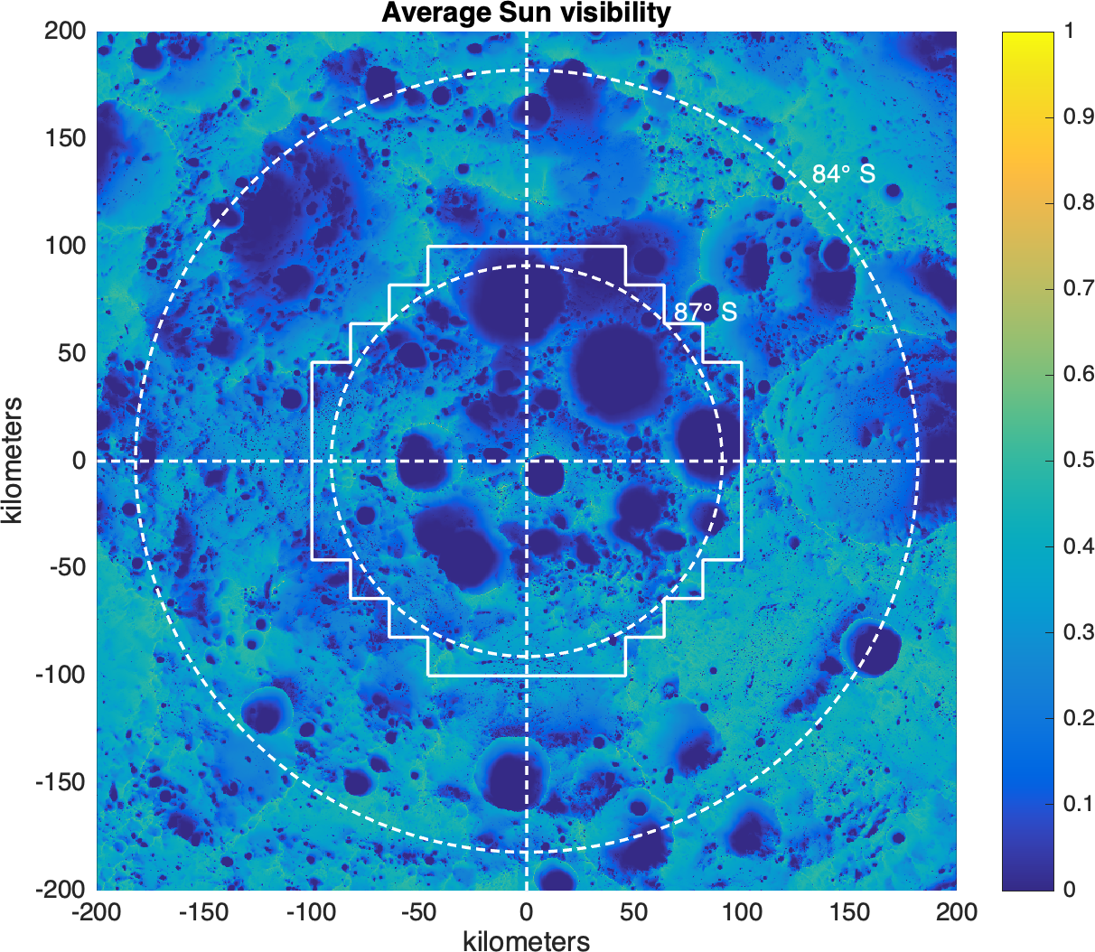
This product was constructed from 97 individual 20x20 km fields with 2 km overlaps.
Each field was processed with the same method as the individual regions previously created see here) and as described in Barker et al. (2021).
The fields were then individually aligned to the original DEM with a rigid 3-D translation
and blended together with a cosine taper weight in the overlap regions.
The counts (ldec) and slope (ldsm) maps of the individual fields were blended in the same way.
Hence, non-integer counts exist in the overlap regions of the final mosaicked product (solid white lines in figure).
Due to the track adjustment, cleaning, and tile blending procedures, this 87-90 deg mosaic product has a typical RMS residual of 30-55 cm with the individual fields (from here).
Data
5 m/pix GeoTiffs with south polar stereographic X/Y coords in meters, MOON_ME reference frame of ephemeris DE421.
X/Y coords follow the Generic Mapping Tools 'pixel-registered' convention (i.e., they are the centers of the pixels).
ldem_87s_5mpp: 3.3GB GeoTIFF of surface height Z (meters) with interpolation fillin g empty pix
ldem_87s_5mpp_hillshade: 820MB GeoTIFF hillshade of ldem
ldsm_87s_5mpp: 4.9GB GeoTIFF of surface slope (degrees)
ldec_87s_5mpp: 140MB GeoTIFF of the number of LOLA returns in each pixel (count map )
Please cite the following reference when using any of these products:
Barker et al., 2021, "Improved LOLA Elevation Maps for South Pole Landing Sites: Error Estimates and Their Impact on Illumination Conditions", Planetary & Space Science, Volume 203, 1 September 2021, 105119, https://doi.org/10.1016/j.pss.2020.105119